This software sharpens edges in an image by inverse filtering. Inverse filtering reverses the effect of filtering or
blurring, increasing image contrast. Example of edge sharpening by this software are given below. The software
works on both gray-scale and color images. Fig. 1a is a Landsat thematic mapper image, and Figs. 1b-d are
sharpened images at increased degrees. Fig. 2a shows a terrain image and Figs. 2b and 2c show sharpened
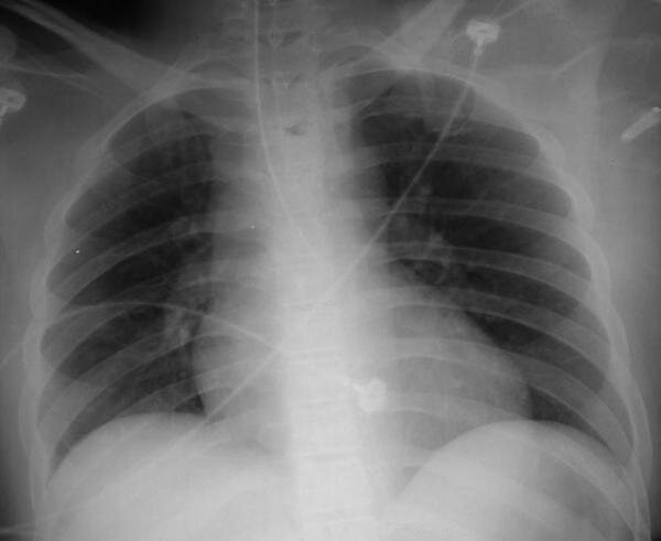
terrain images. Fig. 3a shows a chest X-ray and Fig. 3b shows the X-ray after edge sharpening.
Fig. 1. (a) A Landsat Thematic Mapper image. This image is courtesy of USGS. (b)--(e) The
Landsat image after edge sharpening at increasing sharpness levels.
|
To obtain this edge sharpening software, please follow this link =>
Image Registration and Fusion Systems
|
Fig. 2. (a) A terrain image and (b)--(c) its enhanced versions at increasing sharpness levels.
|
Fig. 3. (a) A chest X-ray and (b) its edge-sharpened image. The X-ray is courtesy of MedPix.
|